Grand Canyon Map & Guide
$10.00
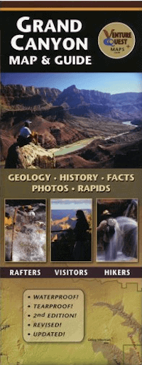
This guide offers a wealth of information with colorful illustrations, photos, and historical anecdotes. It covers the entire Grand Canyon and the reverse side focuses on the central corridor. Revised and updated, this map is the all-in-one canyon resource.
Description
Grand Canyon Map & Guide
by Bronze Black
The Grand Canyon Map and Guide is a comprehensive resource for Grand Canyon National Park, covering the entire Grand Canyon from Lake Powell to Lake Mead. It contains a thorough review of geology, plants, animals, and human history. Beautiful color photographs illustrate many features and key locations. It is great for sightseeing and perfect for a day hike, backpack trip, or raft adventure! This map has been used in educational exhibits in Grand Canyon National Park as well as the National Geographic Visitor Center near Grand Canyon. The Grand Canyon Map and Guide labels all of the major side canyons, rapids, points along the rim and all the major buttes, and temples within the Grand Canyon. Author, Bronze Black has combined his background in geology, graphic design, and river running to produce this unique, compact, and educational map. 2nd edition 2008, 22 x 30 inch poster, folds to 4.5 x 11 inches, water-proof, tearproof.
About the Author:
Author and creator, Bronze Black, is a Geologist, Graphic Designer, Photographer, and Professional River Guide in Grand Canyon.
Reviews:
The The Grand Canyon Map and Guide offers a wealth of information for the serious student of the Grand Canyon region. With pertinent graphics, illustrative photographs, and tantalizing facts, this valuable resource makes the perfect companion whether you are in the backcountry, on the trail, or running the river. As both an educator and an avid hiker I find myself referring to this map time and time again. –Mike Buchheit, Director, Grand Canyon Field Institute




Reviews
There are no reviews yet.