Colorado River Rafting
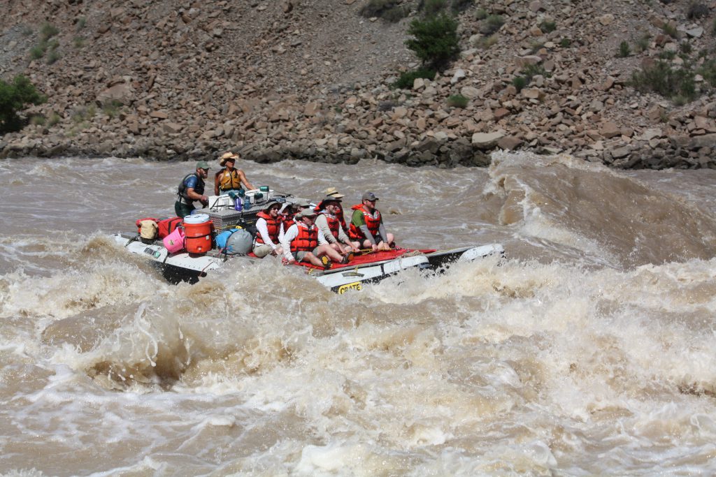
Our Top 3 Picks For Rafting the Colorado River
Why Choose CRATE?
- Under Original Ownership Since 1971
- 5 Star Rated Rafting Trips
- We Provide Everything You Need For a Great Rafting Trip
Book Your Adventure Today!
(800) 253-7328
Home » Rafting Down the River with CRATE » Colorado River Rafting
Colorado River Rafting
Slow Motion Ride Through Hermit Rapid, Colorado River, Grand Canyon
A Guide to the Best Colorado River Rafting Trips
Experience the adventure of a lifetime with Colorado River & Trail Expeditions! We offer unforgettable Colorado River rafting trips through Utah and Arizona, where you’ll navigate thrilling rapids, explore breathtaking desert landscapes, and immerse yourself in the rich history of the American Southwest.
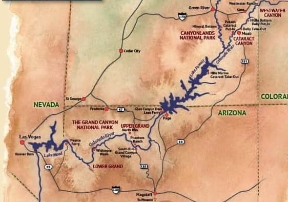
From the Colorado-Utah border to Lake Mead, the Colorado River winds through some of the most spectacular scenery on Earth, including Canyonlands National Park and Grand Canyon National Park. Whether you’re seeking heart-pounding rapids or a scenic float, we have the perfect rafting trip for you.
The Colorado River: A Natural Wonder
Stretching 1,450 miles, the Colorado River originates in the Rocky Mountains at La Poudre Pass and flows through diverse landscapes before reaching the Colorado Plateau. As it carves its way through Grand Valley, Ruby Canyon, and Horsethief Canyons, it creates an unparalleled playground for rafters of all experience levels.
Top Colorado River Rafting Trips
From thrilling rapids to scenic floats, the Colorado River offers diverse rafting adventures for every type of explorer. Here are the most popular sections to raft, each offering unique landscapes, history, and whitewater excitement:
1. Grand Canyon Rafting – The Ultimate Colorado River Adventure
🚣 Best for: Multi-day expeditions, breathtaking scenery, and world-class whitewater.
💦 Rapids: Class III-IV rapids, including Lava Falls & Crystal Rapid.
🌄 Highlights: Towering canyon walls, hidden waterfalls, ancient ruins, and wildlife.
🔗 Explore Grand Canyon Rafting Trips »
2. Cataract Canyon – Big Water, Big Adventure
🚣 Best for: Large Rapids during spring run-off. The best way to see Canyonlands National Park.
💦 Rapids: 30+ rapids, including Brown Betty, Big Drops, & Satan’s Gut.
🌄 Highlights: Stunning red rock landscapes, off-river hikes, and beautiful sand beaches in Cataract Canyon.
🔗 Discover Cataract Canyon Rafting »
3. Westwater Canyon (River Mile 128-111) – Short, Exciting & Scenic
🚣 Best for: The best overnight river trip in the world.
💦 Rapids: Class III-IV rapids, including Skull, Funnel Falls & Sock-It-To-Me.
🌄 Highlights: Towering canyon walls, wildlife, and historical outlaw hideouts.
🔗 Book a Westwater Canyon Rafting Trip »
4. Fisher Towers / Moab Daily (River Mile 88-74) – Family-Friendly Fun
🚣 Best for: First-time rafters, families, and scenic half-day to full-day trips.
💦 Rapids: Mild Class I-II rapids, great for all ages.
🌄 Highlights: Red rock formations, easy rapids, and great swimming spots.
🔗 Plan Your Moab Rafting Trip »
5. Horseshoe Bend / Glen Canyon (River Mile 15-0) – Scenic Float Through a Natural Wonder
🚣 Best for: A peaceful, calm water float with incredible views.
💦 Rapids: None – a smooth, relaxing ride.
🌄 Highlights: The iconic Horseshoe Bend, towering canyon walls, and crystal-clear waters.
🔗 Learn More About Horseshoe Bend Rafting »
Understanding Colorado River Miles: A Guide for Colorado River Rafting
The measurement of Colorado River miles depends on the section of the river. Above the confluence of the Colorado River and the Green River, river miles are measured as distance above the confluence. Below the confluence, including Cataract Canyon, the mileage is measured as above Lees Ferry. Lees Ferry is mile 0. Lees Ferry is located 216.5 miles below the confluence of the Colorado and Green Rivers.
In the Grand Canyon, the river mileage is determined by how many miles below Lees Ferry something is. Understanding how Colorado River miles are measured is crucial when planning rafting trips in either Cataract Canyon or the Grand Canyon.
Rafting Westwater Canyon (River Mile 128-111)
Westwater Canyon 1-Day Rafting Trip
Westwater Canyon 2-Day Overnight Rafting Trip
Westwater Canyon 3-Day Colorado River Expedition
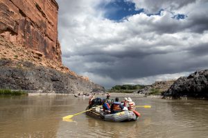
Westwater Canyon Rafting – The Best Short Whitewater Rafting Trip on the Colorado River
Westwater Canyon is one of the most thrilling and scenic Colorado River rafting destinations, offering a mix of exciting Class III-IV rapids, breathtaking canyon scenery, and rich history. Located in eastern Utah, this section of the Colorado River is often called the “West’s Best Overnight Whitewater River Trip”—perfect for both first-time rafters and experienced adventurers looking for a quick, action-packed getaway.
Westwater Canyon Rafting Trips
🚣 1-Day Westwater Canyon Rafting Trip – A high-energy adventure through Class III-IV rapids, ideal for those short on time but craving excitement.
⛺ 2-Day Overnight Westwater Canyon Trip – Experience the beauty of the canyon with a night of riverside camping under the stars.
🌅 3-Day Westwater Canyon Expedition – Continue past Westwater into the Scenic Moab Daily section of the Colorado River.
What Makes Westwater Canyon a Must-Raft Section of the Colorado River?
1. Exciting Whitewater Rapids
The Colorado River picks up speed as it carves through the narrow, rock-walled gorge of Westwater Canyon, delivering a series of legendary rapids. Be prepared for the adrenaline rush of Marble Canyon Rapid, Skull Rapid, Funnel Falls, Sock-It-To-Me, and Last Chance Rapid. The rapids are more technical at medium to low flows, offering a dynamic rafting experience year-round.
2. Stunning Canyon Scenery
Westwater Canyon is a visual masterpiece. As you raft through this stretch of the Colorado River, you’ll see:
- Towering red rock cliffs of Wingate Sandstone.
- Precambrian Black Rock formations—some of the oldest exposed rock in North America (similar to those found at the bottom of the Grand Canyon).
- Desert wildlife, including bald eagles, great blue herons, and bighorn sheep.
3. Rich History & Hidden Landmarks
This section of the Colorado River is filled with fascinating historical sites:
- An early 1900s dugout cabin, believed to have been used by gold prospectors.
- A mysterious cave, rumored to have housed outlaws and counterfeiters.
- Stories of early explorers like Bert Loper and Ellsworth Kolb, who first navigated this canyon in 1916.
4. Relaxing Scenic Floats & Riverside Camping
After the rapids, the river calms, offering time to float in your lifejacket and soak in the incredible desert landscape. For multi-day rafting trips, Big Horn Camp is a favorite camping spot, featuring a sandy beach nestled among ancient Precambrian rock formations.
Why Choose Westwater Canyon for Your Colorado River Rafting Adventure?
✅ Best Short-Trip Whitewater Experience – Perfect for those looking for a quick but thrilling rafting trip.
✅ Amazing Scenery – A mix of red rock canyons, towering cliffs, and ancient rock formations.
✅ Exciting Rapids – Experience some of the best Colorado River whitewater outside the Grand Canyon.
✅ Wildlife & History – Spot bald eagles, explore hidden caves, and learn about the river’s storied past.
Book Your Westwater Canyon Rafting Trip Today!
Whether you’re looking for a one-day whitewater adventure or a multi-day rafting and camping experience, Westwater Canyon is an unforgettable way to explore the Colorado River.
📞 Call us at (800) 253-7328 or visit our Reservations Page
Cisco to Fisher Towers (River Mile 111-88)
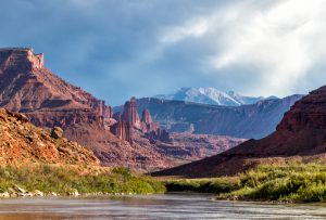
Rafting the Cisco to Fisher Towers Section of the Colorado River
For those looking for a scenic and wildlife rich Colorado River rafting experience, the Cisco to Fisher Towers section offers a beautiful float trip with stunning desert landscapes, abundant wildlife, and fascinating history. While this stretch of the Colorado River does not feature whitewater rapids, the steady current, natural obstacles, and rock formations make for a fun and engaging rafting experience.
This section is often paired with Westwater Canyon rafting trips, offering a balance between thrilling whitewater and relaxing desert scenery or as an extension to our Fisher Towers section for large youth groups wanting to spend more than a day on the river.
What to Expect on This Colorado River Rafting Trip
🚣 Fast-Moving Water & Natural Obstacles – While there are no major rapids, this section keeps things exciting with swift currents and unique rock formations.
🌄 Incredible Scenery – Raft past towering red rock cliffs, lush riverbanks, and panoramic views of the La Sal Mountains.
🦅 Wildlife Viewing – Keep an eye out for bald eagles, great blue herons, bighorn sheep, and river otters along the shoreline. We regularly hear Elk bugling during September trips and have even seen a Black Bear swimming across the river.
🌉 Historic Landmarks – Float beneath the remains of Dewey Bridge, a historic suspension bridge that burned in 2007.
🛣 Scenic Highway 128 – This section runs parallel to one of Utah’s most breathtaking scenic drives.
🌙 Riverside Camping – Several remote riverside campsites make this a great option for overnight rafting trips.
Perfect for Youth Groups & Beginner Rafters
The Cisco to Fisher Towers stretch is ideal for:
✅ Youth groups and large rafting parties – A fun introduction to Colorado River rafting.
✅ Families and first-time rafters – A great way to enjoy the river and desert scenery.
✅ Wildlife and photography enthusiasts – A chance to experience the beauty of the Colorado River corridor up close.
Many rafters combine this trip with Westwater Canyon for a mix of intense whitewater and relaxing scenic floating, creating a diverse multi-day rafting experience.
The Moab Daily-Fisher Towers Section of the Colorado River(River Mile 88-74)
1-Day Moab Rafting on the Colorado River
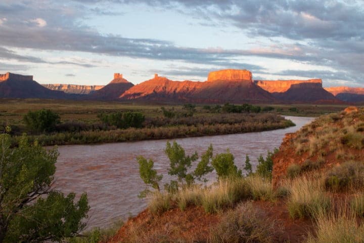
1-Day Moab Rafting on the Colorado River – The Perfect Family Adventure
The Moab Daily section of the Colorado River is one of the most popular and accessible rafting trips in Utah, offering a mix of gentle rapids, stunning red rock scenery, and plenty of opportunities for adventure. This one-day rafting trip is perfect for families, first-time rafters, and those looking for a fun, laid-back experience on the river.
Starting at Hittle Bottom and ending at the Moab Daily Take-Out, this section of the Colorado River features moderate Class I-II rapids, making it an excellent introduction to Colorado River rafting. With options for paddle boats, inflatable kayaks, and guided rafting trips, this adventure is designed for all levels of rafters.
What to Expect on the Moab Daily Rafting Trip
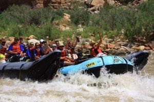
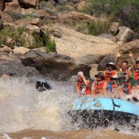
🚣 Fun, Rolling Rapids – Enjoy a mix of small waves and splashy rapids that provide just the right amount of excitement.
🌄 Iconic Moab Scenery – Raft through a landscape of towering red rock cliffs, desert mesas, and views of the La Sal Mountains.
👨👩👧👦 Great for Families & Groups – The gentle current and approachable rapids make this a fantastic trip for kids, beginners, and multi-generational groups.
💦 Choose Your Level of Adventure – Want more excitement? Upgrade to a paddle raft or take on the river in an inflatable kayak for a hands-on whitewater experience.
🐦 Wildlife Viewing – Keep an eye out for bald eagles, great blue herons, big horn sheep, and river otters along the banks of the Colorado River.
Make the Most of Your Moab Rafting Adventure
One of the best things about rafting the Moab Daily section is the flexibility to customize your experience.
✅ Paddle Rafts – Work as a team to navigate the Colorado River rapids, making your experience more interactive.
✅ Inflatable Kayaks – Get up close and personal with the waves! Even small rapids feel like big whitewater when you’re paddling your own kayak.
✅ Guided Rafting Trips – Let our experienced guides lead the way, sharing fascinating stories about the history, geology, and wildlife of the Colorado River.
No matter how you choose to raft, the Moab Daily guarantees beautiful scenery, plenty of splashy fun, and an unforgettable day on the water.
Book Your Moab Colorado River Rafting Trip Today!
If you’re looking for a fun and scenic one-day rafting adventure, the Moab Daily section of the Colorado River is the perfect choice.
📞 Call us at (800) 253-7328 or visit our Reservations Page.
Colorado River Beyond The Daily Section To Potash (River Mile 74-47)
As the Colorado River flows beyond the Moab Daily section, it enters a stunningly scenic stretch that winds through the Moab Valley, past the Scott M. Matheson Wetlands Preserve, and into The Portal, where towering sandstone cliffs mark the gateway to Canyonlands. This section of the Colorado River is known for its calm waters, breathtaking red rock scenery, and fascinating geological features, making it a great extension for those looking to explore more of the river.
What to Expect on This Section of the Colorado River
🚣 A Scenic, Tranquil Float – Unlike the rapids found upstream, this section of the Colorado River is mostly calm, offering an ideal opportunity to relax and take in the surrounding beauty.
🌿 Scott M. Matheson Wetlands Preserve – This lush river oasis is home to a variety of bird species and other desert wildlife, making it a must-see for nature lovers.
🧗♂️ “Wall Street” Sandstone Cliffs – A world-famous rock climbing destination, these towering cliffs rise dramatically from the banks of the Colorado River, offering stunning views and thrilling challenges for climbers.
🏜 Iconic Desert Landscapes – As the river approaches Potash, rafters are treated to panoramic views of the La Sal Mountains, jagged red rock formations, and the dramatic canyon walls leading toward the confluence with the Green River.
📍 Gateway to Canyonlands – This section leads toward Canyonlands National Park, where the Colorado River meets the Green River, setting the stage for more adventurous rafting trips like Cataract Canyon.
Who Should Explore This Stretch of the Colorado River?
✅ Nature & Wildlife Enthusiasts – A peaceful float through lush wetlands and desert terrain, perfect for spotting native wildlife.
✅ Rock Climbers & Outdoor Adventurers – A chance to experience the famous Wall Street cliffs from the river or stop for a climb.
✅ Paddleboarders & Kayakers – The gentle flow makes it an excellent section for paddleboarding, canoeing, and kayaking.
✅ Scenic Rafters – A great option for those looking to experience a laid-back stretch of Colorado River rafting without intense rapids.
Cataract Canyon Rafting (River Mile 47-169 *Confluence is mile 0/216.5)
Colorado River Trips Through Cataract Canyon
⛺ 4-Day Cataract Canyon Rafting Adventure – A thrilling journey through the heart of Canyonlands National Park, packed with whitewater excitement and stunning scenery.
🚣6-Day Cataract Canyon Rafting Expedition – A more immersive trip with extra time for hiking, exploring ancient ruins, and soaking in the beauty of Cataract Canyon.
🥾 7-Day Spring Special: Cataract Canyon Rafting & Hiking – A unique springtime adventure with extended off-river hikes and and hidden side canyons.
1. Big Water, Big Rapids
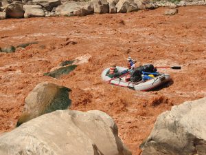 Cataract Canyon is home to some of the most powerful whitewater on the Colorado River, especially during peak runoff. With around 30 rapids packed into a 14-mile stretch, this section delivers intense Class III-V whitewater, making it one of the most exhilarating rafting experiences in North America. Rapids like Big Drops 1, 2, and 3, Capsize, Mile Long, and Satan’s Gut promise heart-pounding adventure.
- High Water (May–June): Flows can reach up to 100,000 cubic feet per second (cfs), creating monstrous waves and massive hydraulics.
- Lower Water (Late Summer–Fall): The rapids become more technical, requiring precise navigation through rapids strewn with exposed rocks.
2. Spectacular Scenery & Geological Wonders
Cataract Canyon cuts through the breathtaking landscapes of Canyonlands National Park, offering some of the most stunning desert scenery in the Southwest. As you raft through this remote canyon, you’ll see:
✅ Towering red rock cliffs and dramatic sandstone formations
✅ Hidden waterfalls that only flow during the Spring or after a monsoon rain.
✅ The Confluence of the Green and Colorado Rivers, first mapped by John Wesley Powell in 1869
✅ Panoramic views from hikes to The Loop and The Doll’s House
3. Rich History & Ancient Ruins
This stretch of the Colorado River has a deep historical and cultural significance. Along the way, you’ll discover:
🏺 Ancestral Puebloan ruins and pictographs.
🛶 The historic route of John Wesley Powell’s 1869 expedition, the first recorded descent of Cataract Canyon
⛺ Historic inscriptions from past river runners, surveyors, and trappers.
4. Multi-Day Adventure with Riverside Camping
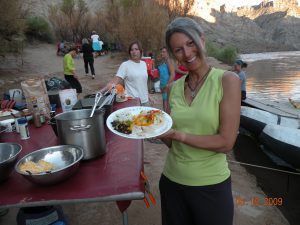 A Cataract Canyon rafting trip isn’t just about the rapids—it’s about the full wilderness experience. Each night, we set up camp at a beautiful location, enjoy delicious riverside meals, and fall asleep under a blanket of stars. Each day is different, and may be filled with hiking, exploring slot canyons, and relaxing in nature.
Why Choose Cataract Canyon for Your Colorado River Rafting Adventure?
✅ Legendary Whitewater – Some of the biggest rapids on the Colorado River.
✅ Breathtaking Scenery – Raft through the stunning canyons of Canyonlands National Park.
✅ Rich History & Exploration – Follow in the footsteps of John Wesley Powell and explore ancient ruins.
✅ The Ultimate Multi-Day Experience – Combine whitewater thrills with hiking, camping, and relaxation.
Whether you want to experience the rapids during high-water or a scenic multi-day rafting and hiking experience, Cataract Canyon is an unforgettable way to explore the Colorado River, and the best way to see Canyonlands National Park.
📞 Book Your Cataract Canyon Rafting Trip Today!
Call us at (800) 253-7328 or visit our Reservations Page to plan your adventure!
Hite Marina to Glen Canyon Dam (River Mile 169-15)
Glen Canyon: The Lost Treasure of the Colorado River
Before the creation of Lake Powell, Glen Canyon was one of the most breathtaking sections of the Colorado River, known for its towering sandstone walls, hidden grottoes, and serene beauty. This stretch of river was once a premier destination for rafting, offering a peaceful yet awe-inspiring journey through a canyon system that many consider unmatched in its natural grandeur.
Today, Glen Canyon is often referred to as “The Place No One Knew”—a reference to how few people had the chance to experience its wonders before it was submerged beneath the reservoir. The loss of Glen Canyon remains one of the most profound transformations of the Colorado River, a reminder of the delicate balance between conservation and development.
“The chance to float quietly down a calm river, to let the current reveal a thousand years of history, the wild heritage that belonged in Glen, a canyon itself alive. Incredible, haunting beauty, where the creations of the Colorado rivaled any in the world, where the side canyons simply had no rivals. We lost wholeness, integrity, in a place no one knew well enough, in a place that might always have let people know how magnificent a gesture is the natural world.”
— Phil Pennington and Chuck Washburn, from Glen Canyon, 1963.
Though much of Glen Canyon now lies beneath Lake Powell, remnants of its beauty can still be seen in exposed sections during times of lower water levels. For those who appreciate the history and legacy of the Colorado River, Glen Canyon serves as both a lost paradise and a symbol of the ever-changing landscape of the American West.
Horseshoe Bend & the Final Stretch of Glen Canyon(River Mile 15-0)
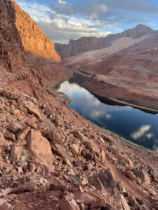 This 15-mile section of the Colorado River marks the last remaining stretch of Glen Canyon, offering a rare glimpse into the beauty that once defined the entire region. One of the most famous landmarks along this route is Horseshoe Bend, where the Colorado River carves a dramatic, 270-degree curve through towering red rock cliffs.
Horseshoe Bend: A Must-See Colorado River Landmark
📸 Iconic Views – The classic viewpoint, perched 1,000 feet above the river, is one of the most photographed locations in the Southwest. Visitors from around the world hike to this overlook to capture the stunning, panoramic view of the river’s meandering path.
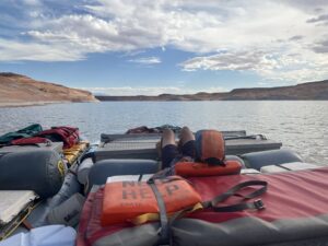
🚣 Float Through Horseshoe Bend – For a completely different perspective, you can raft or kayak around the bend itself, experiencing the sheer canyon walls from water level. This calm water section of the Colorado River is perfect for a scenic float, offering breathtaking views and a peaceful, immersive experience.
As one of the last accessible parts of Glen Canyon, this section of the Colorado River provides a unique opportunity to witness the remnants of a lost canyon while taking in one of the most spectacular river landscapes in the world.
Rafting the Grand Canyon of the Colorado River (River Mile 0-280)
8-Day Full Grand Canyon Rafting Expedition
7-Day Grand Canyon Rafting Expedition with Helicopter Take-Out at Whitmore Wash
3-Day Grand Canyon Ranch and Rafting Expedition from Las Vegas
4-Day Grand Canyon Ranch and Rafting Expedition from Las Vegas
Grand Canyon Rafting: The Ultimate Colorado River Adventure
The Grand Canyon of the Colorado River is one of the world’s most breathtaking natural wonders. While standing at the rim offers an awe-inspiring view of its vast, colorful layers, nothing compares to rafting through the heart of the canyon, where the river has carved its way through more than a mile of ancient rock over millions of years.
The Grand Canyon Rafting Experience
🚣 280 Miles of Adventure – From Lee’s Ferry to Lake Mead, the Colorado River flows through the depths of the Grand Canyon, creating a thrilling mix of roaring rapids and peaceful stretches of calm water.
🌊 Legendary Rapids – Rapids form where debris from side canyons has been washed into the river. These range from gentle riffles to powerful whitewater rapids, delivering an exhilarating ride.
🏞 Breathtaking Scenery – Between the rapids, the river slows, allowing time to gaze up at sheer cliffs of polished granite and fluted schist. Around every bend, new and unexpected vistas unfold—towering rock formations, hidden waterfalls, and colorful desert landscapes.
Beyond the River: Exploring the Grand Canyon
🥾 Daily Off-River Hiking – Grand Canyon rafting isn’t just about the river; it’s about discovering the wonders hidden within the canyon’s side canyons and plateaus. Our commitment to off-river exploration means guests experience spectacular hikes that many other travelers miss.
🏜 Hidden Waterfalls & Natural Pools – Some trails lead to cascading waterfalls, crystal-clear pools, and lush vegetation, where tropical monkey flowers bloom alongside desert cacti.
🔎 Ancient Sites & Panoramic Views – Other hikes take you to Ancestral Puebloan ruins, historic landmarks, and high plateaus with sweeping views of the canyon’s vast expanse.
🌿 Wilderness Walks – Not every hike has a destination—sometimes the best experiences come from simply walking cross-country, taking in the diverse flora and fauna of the Grand Canyon.
Why Raft the Grand Canyon with Us?
✅ The Ultimate Colorado River Experience – Witness the Grand Canyon from its most breathtaking vantage point: the river itself.
✅ Unforgettable Whitewater & Scenic Floats – A perfect balance of thrilling rapids and peaceful, scenic stretches.
✅ Exclusive Hiking Opportunities – Explore hidden gems and see places that most Grand Canyon travelers never experience.
✅ Immersive Wilderness Adventure – Disconnect from the outside world and experience the canyon up close and personal.
Whether you’re looking for a whitewater adventure or a multi-day journey through one of the most remote and beautiful places on Earth, rafting the Grand Canyon is an experience like no other.
📞 Book Your Grand Canyon Rafting Trip Today!
Call us at (800) 253-7328 or visit our Reservations Page to start your adventure!
Below the Grand Canyon: The Colorado River’s Journey
After leaving the Grand Canyon, the Colorado River flows into Lake Mead, the largest reservoir by volume in the United States when full. This vast lake was created by the construction of Hoover Dam, the first major dam on the Colorado River, built between 1931 and 1936.
The Dams of the Lower Colorado River
As the Colorado River continues its journey south, it is regulated by a series of dams that manage water distribution, hydroelectric power, and irrigation:
🔹 Hoover Dam – Forms Lake Mead and provides hydroelectric power to millions.
🔹 Davis Dam – Creates Lake Mohave and regulates water releases downstream.
🔹 Parker Dam – Forms Lake Havasu, a key water source for California and Arizona.
🔹 Headgate Rock Dam – Forms Lake Moovalya and provides irrigation for farming in the surrounding areas.
🔹 Palo Verde & Imperial Dams – Direct water into major irrigation canals for agriculture.
🔹 Laguna Dam – One of the oldest diversion dams on the Colorado River.
🔹 Morelos Dam (Mexico) – The last dam before the river reaches its historic delta.
The Final Stretch to the Sea of Cortez
Historically, the Colorado River flowed freely into the Sea of Cortez, creating a lush delta teeming with wildlife. Today, due to extensive water usage and diversion, the river rarely reaches the sea. When water flows remain, the Colorado completes its long journey, reconnecting with the ocean and sustaining the delicate ecosystems of its delta.
This lower section of the river tells the story of human influence—how the Colorado River, once a wild and untamed force, has been transformed to meet the water and power needs of the Southwest.
If you have any questions or to book an adventure today please call us at (800) 253-7328.
Grand Canyon River Rafting Recommendations
Spring Hiking & Rafting Special
The focus is on off-river hiking and exploration.
Our classic Grand Canyon rafting expedition. It offers ample time to see the sites and side canyons.
18-Foot rafts are rowed by guides. A paddle raft is available on a rotation basis.
Grand Canyon Rafting combined with a stay at the Bar 10 Ranch.
Home » Rafting Down the River with CRATE » Colorado River Rafting
CRATE Rafting Trips Since 1971
Free PDF copy of our Rafting Brochure!

